I’m not 100% sure how I got here. Though I’m sure I’ll get there, to Lindisfarne that is.
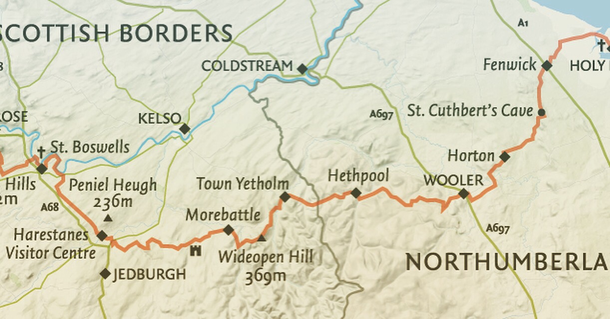
I’m 3 days in to a 4 day trip across the Scottish Borders and Northumberland following the well trodden St Cuthbert’s Way. Skip to the film of this adventure here.
I needed to get some solice after a few hectic months of work and after banking some holiday days I began to plan. Cycle? Run? Walk? All were good but where?
Eventually I stumbled upon this walk after following the Spine Race and researching the Pennine Way and thinking that that was a wee bit too far. The St Cuthbert’s Way follows a tiny section and it caught my eye on the map as I traced The route.
This route appealed to me for its remote setting and almost pilgrimage of a route. I was sold and started to plan. 3 weeks later I was setting out on Sunday past, for my first leg of four. I’d settled for 4 legs as it offered the best stopping places and mileage per day that my legs could cope with right now.
 Melrose Abbey is the starting point, then heading due South over the Eildon Hills. The route was muddy and I started to regret my choice of shoes. Fell shoes would have been better than these road ones but I persevered on. The route is well signed and although dotting between villages manages to find off road trails and paths.
After the steep ascent of the Eildons the route finds the Tweed and meanders around over boardwalk and bridges. The views are stunning. The village of Maxton marks the section that follows Dere Street, an ancient roman road. The route undulates and was on uneven ground. It was hard to get a rhythm. The first leg was over and it was a bit too long as we almost missed the bus to take us back to the car.
The next day, on tired legs, was a struggle. 25kms lay ahead and now with overnight gear to be carried. I packed lightly, all in my running vest. I took Spare clothing to wear in the evening, light weight waterproof and a warm smock. I carried enough food for the day to stock up for the next at the local shop.  I got dropped at the place where I finished the day before and headed up a farm track. I was to see no one for 23kms. The route followed some unclassified roads but mainly tracks and paths. The weather was beautiful, not a drop of wind or cloud in the sky. Absolutely perfect conditions for a March day. The signs continued to point the way.
The route ascended steeply and at the brow of the hill I looked back and in the distance, the Eildens standing proudly on the horizon giving me perspective of where I’ve come. The view west was the first glimpse of the Cheviots, still speckled with snow. I have to admit to feeling a tad apprehensive as if this was the boundary to uncharted land.
It’s strange running solo, I had my mate Tony join me on the 1st leg which made this leg feel really alone. I ran when the gradient allowed and walked unashamedly up the hills. My goal of leg 2 was to reach the village of Kirk Yetholm, a place I’d wanted to visit for some time given its location to the Pennine way.
 I could plot the map on the landscape that laid in front of me and track the distance I’d be travelling. This perspective gave me hope that these tired legs would get a rest. At some point!
I stopped for lunch straddling a dry stone wall looking out over the hills. My legs dangling, my feet throbbing in a well trodden way.
Climbing Wideopen hill the pace had slowed, I took every opportunity to turn and look at the scenery and rest the calves. A plaque at the summit proclaimed this was half way and the highest point on the route. 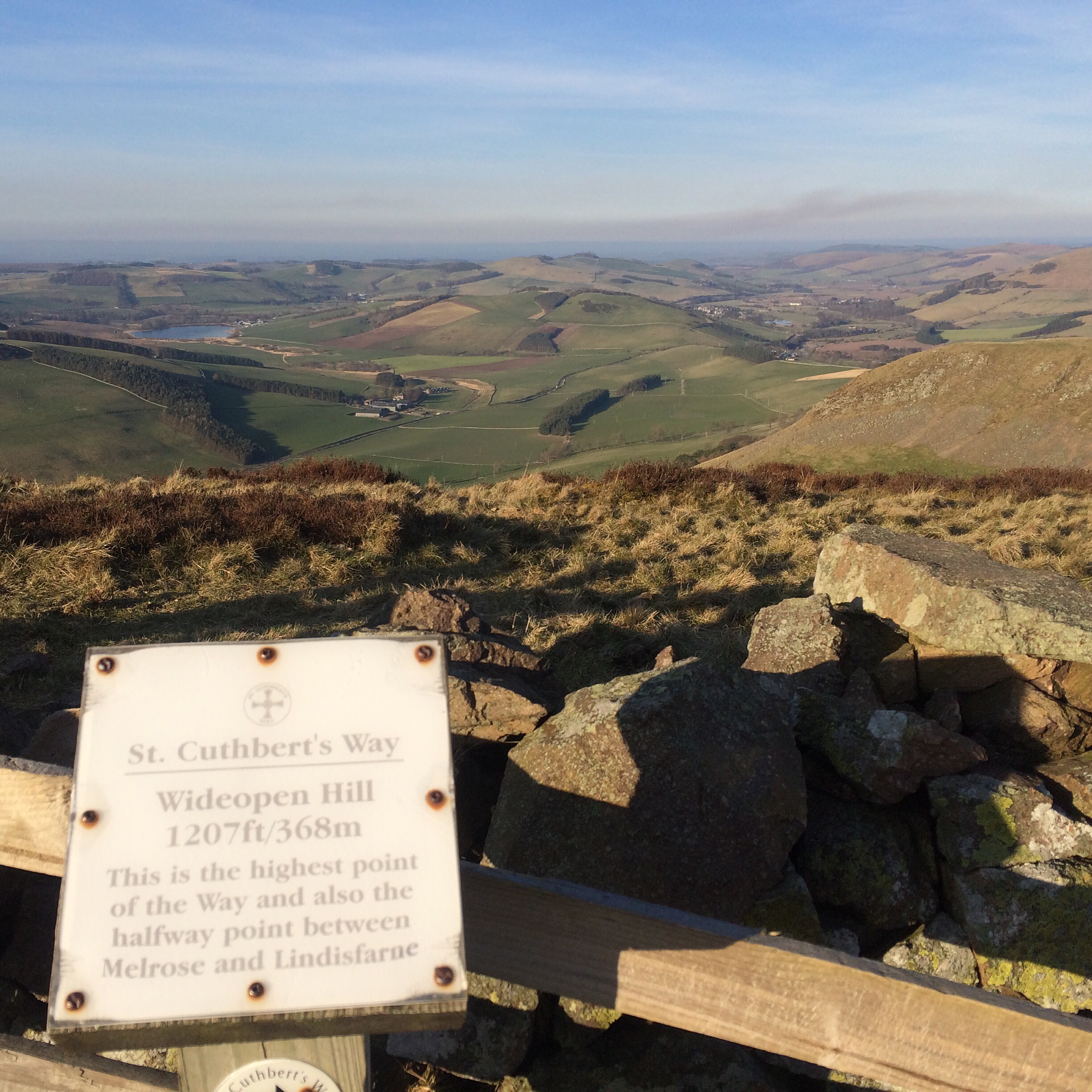
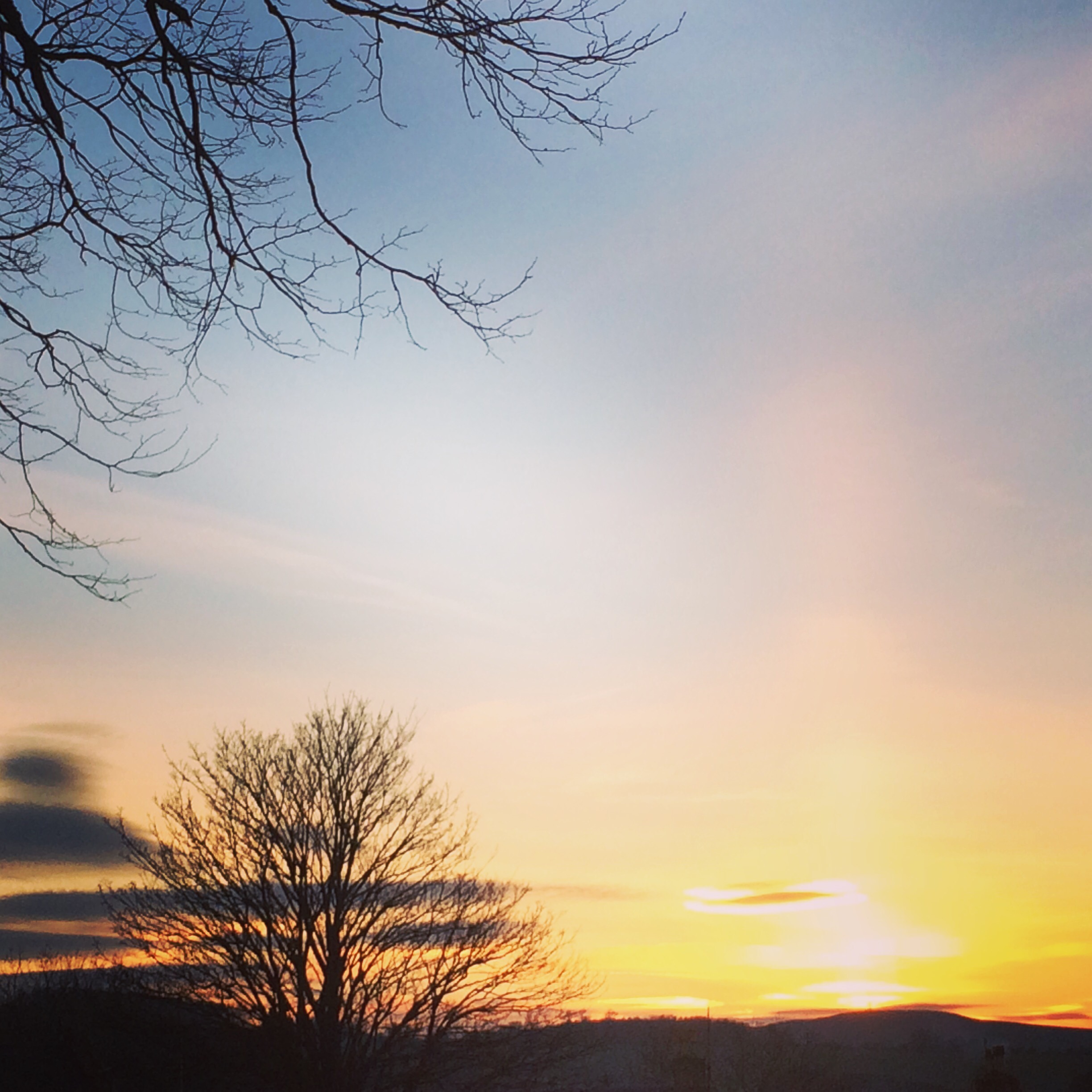
The descent was harsh on the knees. The village of Kirk Yetholm in the distance still in the sunlight with an ever growing shadow approaching its edge.
I ran through a field of sheep and their lambs, their bleating was loud. At last I met some folk on the route, two walkers turned and said hello as I tried not to sneak up on them unannounced. Quick hellos and a chat we proclaimed we’d chat further in the pub. And we did. 25kms makes you thirsty and hungry!
 The next day (today) I woke up with stiff legs and looked outside to a gloom of mist. I ate breakfast earlier than I had thought after the drinks the night before and was ready to get these 21kms over with. The sooner I started and got wet the sooner I’d be dry eating cake in Wooler!
I set off along the start of the Pennine Way. Ascending the hill out the village. It wasn’t long until I was in the cloud and put on my rain jacket.
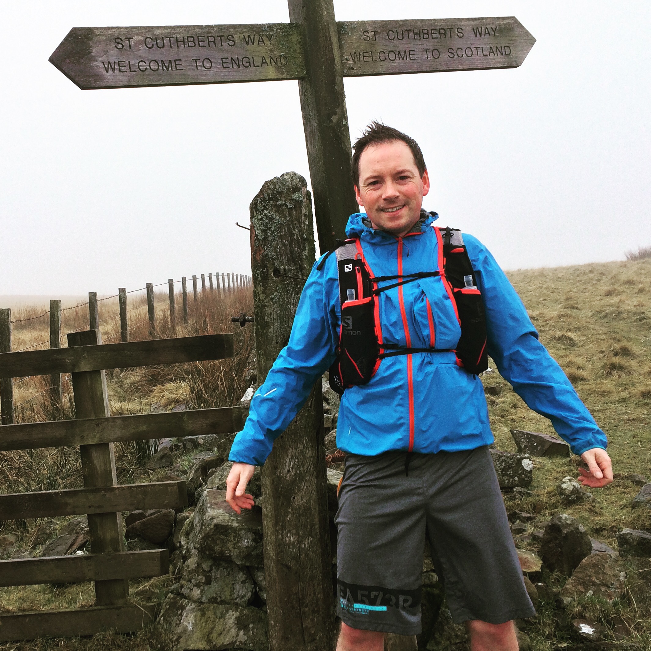
The hills are eery in the mist. A lone signpost high on the edge of the hill pointed the paths. This is the junction where the St Cuthbert’s Way parts from the Pennine Way. I turned left and up. Bog surrounded the path and I resigned to having wet feet. It wasn’t long until I reached the border where a sign reads welcome to Scotland and welcome to England.
The weather didn’t improve in England but the signs changed from the normal footpath to using terms like “access land” and “permissive paths” reminding me of the right to roam in Scotland.
The path continued through wood and forest and over fells. There were no views save a few gaps in the cloud over to neighbouring hills. Patches of snow lay along the northern slopes. I disturbed a few unsuspecting black grouse with their loud bark and warble. I was thankful for the GPS device where signs were infrequently placed and where I needed some comfort that a map brings and knowing your bearing in the cloud.
 Descending into Wooler the mizzle retreated and an overcast sky hung above the town. 72kms done and only 28km to go which will be the last and longest day ahead. Wish me luck. Day 4 Wooler to Lindisfarne lies ahead.

Such an amazing thing to do. I almost wish I was doing it with you
Almost? Lol
Pingback: Last leg #StCuthbertsWay | Run Spud Run!·
Wow that’s just awesome!
Pingback: St Cuthbert’s Way Film | Run Spud Run!·