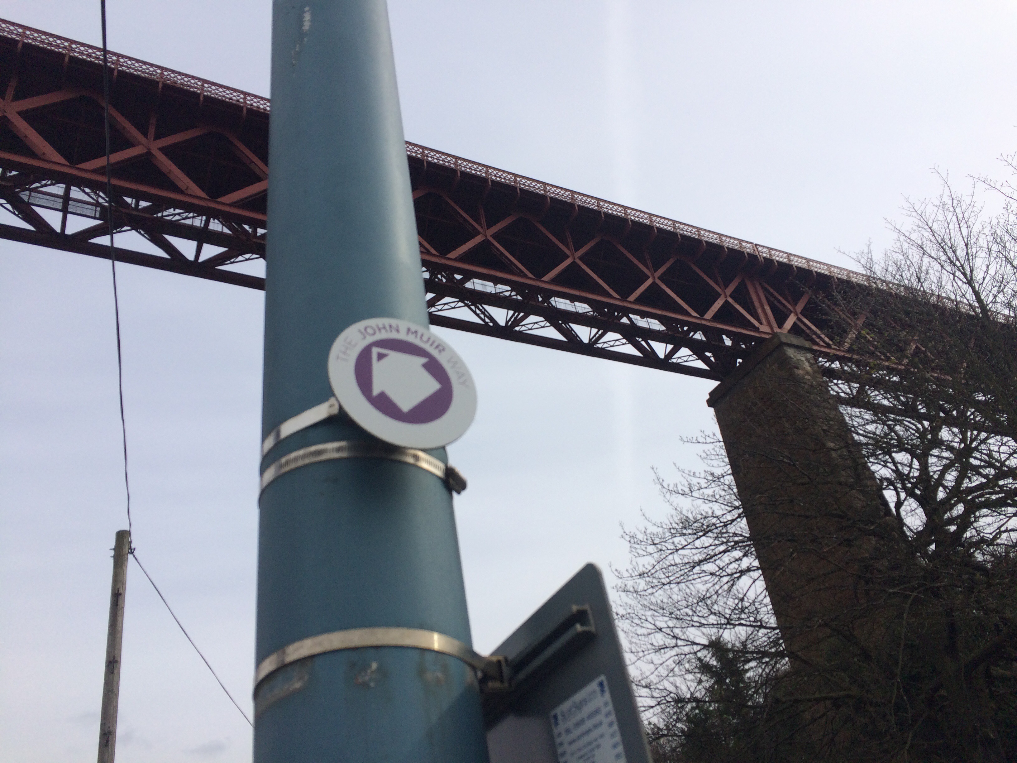
It started on the 1st April. I’d already signed up to the John Muir Ultramarathon at the end of the Month but I’d not even given any thought of doing more of the route until I ended up walking from South Queensferry to Edinburgh. There were the signs. John Muir Way. With my recent St Cuthbert’s Way adventure, I had a thought that I could cover the whole route, and see whether it was possible to do this during April.
That was the start of the challenge.
Pouring over maps and then the calendar I realised that it would be difficult to get the mileage in, and also, would it be possible to finish the route the day of the Ultra?
 Now running is my usual method of gaining distance, but I also wanted to spend time with the Other Half, which meant that I would need to slow things down a bit. I also knew from Ultra training that a good days walk and then the next day run was a good training strategy.
That was settled. I just needed to work out the legs and the logistics.
 I ran the next day from Linlithgow to South Queensferry, logistics were easy due to the presence of Train Stations. As was the next weekend, when Andy and I walked from Falkirk to Linlithgow.
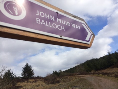
The next weekend, I persuaded Tony, who I’m training with for Breca SwimRun to come for a jaunt. This time, I was heading further west. I needed to get the outer reaches of the route done and decided I would the weekend after be walking the Helensburgh to Strathblane section. The only issue being was public transport on a Sunday around Strathblane. I didn’t want to do too much with Andy, nor did I want to run too much with Tony. Eventually I decided that Tony and I would go out to Milngavie, follow the West Highland Way until it met the John Muir Way and follow it to Croy. I mapped it out and it was around 25kms. Which meant that Helensburgh to Strathblane was the route I needed to do the following weekend.
 The run to Croy was long, longer than I had mapped and turned out to be 32kms! We arrived in Croy puggled and ready for a seat on the train. I was pretty pleased though, as we had a steady pace on tarmac for some distance which is good endurance training at least.
The weekend after, I woke up on the morning and had planned the route and that Andy would pick up a bus when he tired, and I’d run the rest. BUT, on closer inspection to the map on the John Muir Way website, the route had changed from that which I was following and published on the Ordnance Survey Map! I got up quickly, measured the route and realised it was about 21kms. I broke the news to Andy and he didn’t really grumble, so that was settled then. When we reached Carbeth we’d get a taxi to Milngavie and catch the train.
 And that is what we did today.
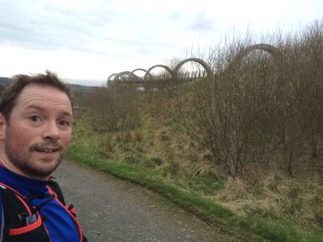
 I’ve found the route accessible for many reasons, transport, through central Scotland, not too remote but off road as much as possible. I’ve discovered places I didn’t know exist and joined the dots of where motorways criss cross paths, canals and minor roads. I’ve seen history before me – Antonine Wall and modern wonders- Falkrik Wheel. Views of Ben Lomond, Pentland hills, Cities and lochs.
I’ve walked on track, grass, tarmac, paved path, gravel tracks, forest roads, and some minor bogs.
I’ve got a week not until the Ultra Marathon from Port Seton to Dunbar. I just need to complete the Edinburgh section to Musselburgh, though I’ve done this route before I should do it again so I’ve got it all done in April.

Loving reading about your adventures this year. I had forgotten totally the word ‘puggled’. 😀 Good luck for the weekend’s ultra.